


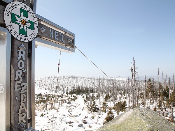
Plechý (1378 m above sea level) is the highest mountain in the Šumava Mountains in the Czech Republic, located on the Czech-Austrian border. Plechý is also the highest mountain in the South Bohemian Region and the Austrian part of the Šumava Mountains. The current name is derived from the German name Plöckenstein, which means "shiny stone or rock." The inspiration for this name likely came from the glistening surface of a lake on its northeastern slope.
We set out to climb Plechý in early spring - specifically at the beginning of March, when spring thaw is usually just beginning. We left Černá v Pošumaví by car around nine o'clock, equipped with snacks, emergency supplies (spare clothing, a light, a knife, and a compass), snowshoes, poles, and good spirits, and drove to Nová Pec, where we parked in the parking lot right next to the mentioned Mountain Service cottage. The first section of the route may be a bit disappointing, as you walk on a relatively high-quality asphalt road, which in places turns into a paved road but is still quite easy to walk. You can choose from several routes, and we completed the hike twice, trying both options on the northeast side. The more thrilling one is, of course, physically more demanding as well. However, the paths meet just below the summit, and the final ascent depends on your determination. The steep climb, though, compensates for the initial disappointment. Spring thaw ensures that the snow is still relatively deep but soft, and you tend to sink into it – thankfully, we had snowshoes! Every step of the steep climb is reminiscent of walking on high, stepped stairs. The views of the surrounding landscape, kneeling, and the characteristic breaks caused by bark beetles will make all the effort worthwhile, and you will take a summit photo with a feeling of conquering Everest.
You can also choose the direction for the return journey from several options. We chose the version leading past the monument to Adalbert Stifter and steeply descending on the northwest slope towards Plešné Lake. This route is also an educational trail called "Spirit of the Primeval Forest."
The monument to Adalbert Stifter (1805-1868), a writer and lover of the Šumava Mountains, was built by Adolf Paleczek and his four helpers between 1876-1877 on the northwestern rocky wall of the cirque above the shore of Plešné Lake below the summit of Plechý. It is in the shape of a slender 14.5 m high obelisk made of blocks of the local pleckenstein granite. From the rocky plateau in front of the monument, you can enjoy a charming view of the lake.
At the lake, you have the opportunity to have a snack because there is a designated seating area. Don't forget, as usual, that you are in a national park, so properly dispose of all trash and, most importantly, take it home with you. Do not swim in the lake, do not throw anything into it; it is the widest monument to the Quaternary glacier in the Czech Republic, and for this reason alone, it makes sense to protect it.
Plešné Lake (formerly Plekenštejn Lake, German: Plöckensteinsee) is a glacial lake at an altitude of 1090 m, with an area of 7.48 ha, a circumference of 1242 m, and a maximum depth of 18.30 m. The moraine dam is up to 40 m high, and the stone sea descends up to 150 m below the lake. The glacial cirque is embedded in the northeastern slope of Plechý. The lake's wall is 260 m high.
For the journey home, you can choose either a longer route, covered with asphalt, which is suitable for cycling, or a purely pedestrian path with a view of the Stone Sea. You enjoy the way down until the moment when the initial asphalt challenge appears before you. Trekking boots will definitely hurt your feet, which have been holding up bravely until now, on the hard surface. However, endure it, the parking lot is approaching, and memories of a fantastic all-day trip to Plechý and Plešné Lake, and a deep breath of fresh Šumava air, will stay with you forever.
GPS - Plechý mountain: N 48°46.27793', E 13°51.43747'
GPS - Adalbert Stifter Monument: N 48°46.59263', E 13°51.44295'
GPS - Plešné Lake: N 48°46.65282', E 13°52.05685'"


